Forest and Land Cover Survey Fieldwork
Tools
The second component of my fieldwork consisted of two parts. One was forest surveys, to measure the health and diversity of local forests, and the other was land cover surveys, to see how accurate the my land cover classification using satellite imagery was. To do these surveys, I hired local guides and taught them how to use forest survey equipment like DBH tapes and laser rangefinders for measuring tree heights.
Here is Drissa measuring the boundaries of a plot. Drissa is an expert hunter and knows the area around Kissa like the back of his hand.

This is Omar, using the laser rangefinder to measure the height of a nearby tree.

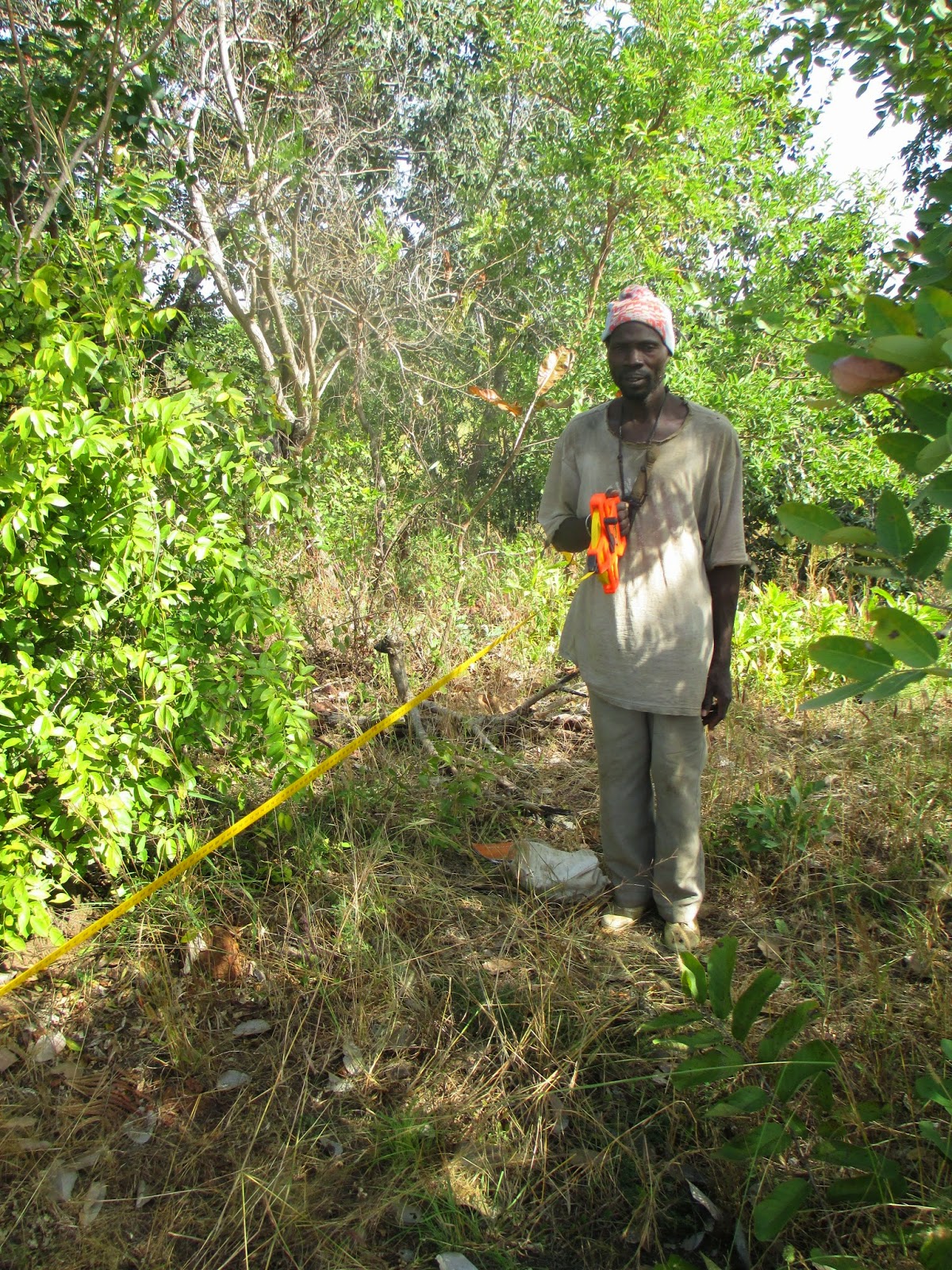
This is Amadou, measuring the DBH (Diameter at Breast Height) of an Isoberlinia tree. Amadou is an excellent student and is almost conversational in English. He had to quit school when his father passed away and his family was no longer able to pay his tuition fees. He is also the only person in Kissa who could consistently beat me at the Connect-4 set that I gave to the village.
The Landscape - A Forest-Savanna Mosaic
Despite having a relatively uniform rainfall distribution latitudinally, Mali's ecosystems are extremely heterogeneous. This is because there is no "climax community" that would eventually dominate in the absence of disturbance. Rather, regimes of grass and forest compete at a landscape scale, based on disturbances like fire, draught, and human activity.
In the Eastern US, for example, forests will dominate when given enough time. If you clear a plot of land, first grasses will grow, then shrubs, and eventually trees. If you do not disturb the area and come back in a hundred years, trees will still be there, because they are the climax community for that ecosystem. Most ecosystems of the world have a climax community, but at the boundary between arid grasslands and tropical rainforests, there is no climax community, and both grasses and trees can potentially dominate. Thus, if you clear a plot of land in southern Mali, halfway between the grasses of the Sahel and rainforests of tropical west africa, in two hundred years, you are just as likely to find grasses as you are forest.
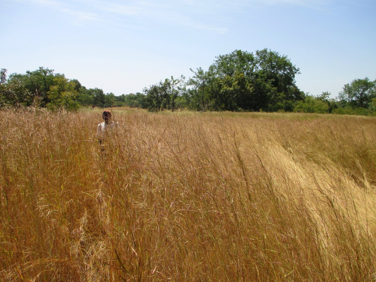
Here are some of the grasslands I'm talking about. At the end of the rainy season, the grass can be over your head!

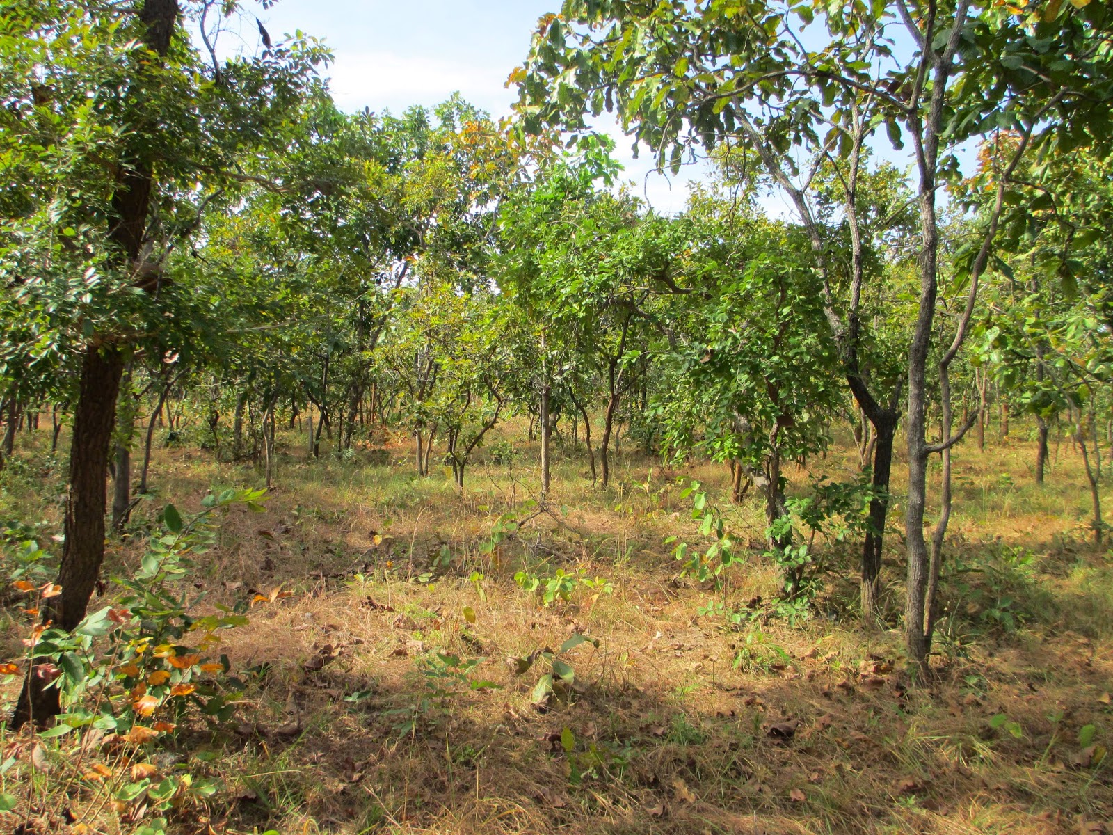
And here I am standing next to a Kapok tree in a heavily forested area near Kissa.
In the two pictures above, there was nothing specific about those particular plots of land that "determined" whether the plant community there would be trees or grasses. In a hundred years, the land in the first picture could look like the second picture, or vice versa.
Human Impacts on the Landscape
The boundary between forested areas and grasslands shifts based on disturbance. Things like fire, severe draught and flooding can cause a once forested area to become grassland, or can make trees sprout where grasses used to dominate. However, human actions are probably the largest drivers of land cover change in Mali. Areas that were once farmed turn to forest, as the tilled soil allows trees roots to grow quickly and they gain an advantage over shallow-rooted grasses. At the same time, people frequently burn grasslands at the end of the dry season, which gives grasses an advantage, as they are more fire-adapted than trees. In fact, people have been impacting the landscape in southern Mali for so long, it is difficult to find examples what a "purely" natural disturbance regime would have looked like, although the african megafauna that are no longer found in Mali likely used to play a large role.

Here is a fire set to a grassland. We were just walking down the trail when my friend paused and said "lets burn this". The fire will stop when it gets to the forest boundary, although it may penetrate the forest a little, extending the grassland's range.

And here is a grassland that has already been burned. Malians burn grasslands because they are much easier to traverse this way and it is easier to spot game.
This area, on the other hand, used to be farmland about twenty years ago. Now, saplings are taking over, shading out the grasses.

This area is an old homestead, where people lived maybe fifty years ago. The fields that people farmed in the immediate vicinity of their houses encouraged forests and the fruit trees that they planted in their household shaded out grasses and fires, leading to this magnificently dense forest.